Stairway To The Sky
Maximum Challenge: The Manitou Incline
Story and photos by Reid Neureiter
For the GPHN

Looking for a physical challenge to target this New Year? How about tackling the Manitou Incline, the mile-long, 2,744 step hiking path that rises 2,011 vertical feet from the town of Manitou Springs at the base of Pikes Peak, 75 miles south of Park Hill? It is a hiking effort unlike anything else, guaranteed to test one’s aerobic and muscular fitness to the maximum.
While the Incline is today a public hiking path, it was originally built in 1907 as a path for a funicular cable car to carry materials to build water pipelines on Pikes Peak. After the pipeline was completed, the cable cars were equipped with passenger seats to take tourists up the steep rise, topping out at an altitude of 8,573 feet, and giving sightseers remarkable views of Manitou Springs and the Colorado plains beyond.
 But a rockslide washed out the tracks in 1990, and the tourist cable car operation was closed. With the rails removed, the ties that were left made excellent rough steps, and climbing the incline became an endurance test, mainly for locals who were in the know. The Incline was private property, so climbing the slope was technically trespassing.

It took an act of Congress to approve the abandonment of the rail line, and an intergovernmental agreement between the city councils of Colorado Springs and Manitou Springs for recreational use of the Incline to become legal in 2013. Pre-COVID-19, an estimated 500,000 people annually made the climb, with more than 1,500 people a day making the attempt in the summer months. While the Incline was closed for five months last spring and summer because of the pandemic, it reopened in August with a free internet-based reservation system limiting the number of hikers per hour.
The reservation regime will continue through the winter, with the Incline open for climbing from 6 a.m. to 2:30 p.m. through March. A staff member greets you at the base of the Incline to verify your reservation. Parking is at a premium in Manitou Springs, and no parking is permitted on the residential streets near the base of the Incline, but the town of Manitou Springs has public parking and a free shuttle that runs every 20 minutes to the Incline.
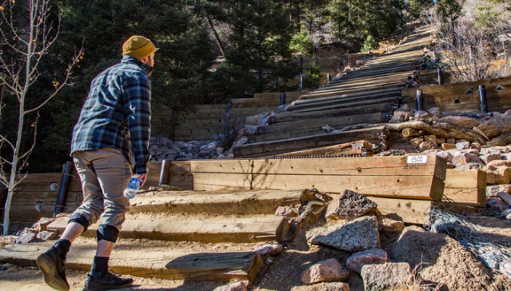
 Signs posted at the base of the climb warn of how strenuous it is, emphasizing the difficulty of any rescue. The signs also instruct that anyone attempting the Incline in winter should wear traction devices, such as micro-spikes, because of ice and packed snow on the trail. This author can personally attest to the seriousness of the effort. The Incline has an average grade of 40 percent and maximum grade of 68 percent, causing some hikers to reach down with their hands to steady themselves as they move up to the next step, making the climb at points seem more like climbing a ladder than moving up stairs.
The stairs are unevenly spaced and higher than normal steps, making it difficult to get in a rhythm, and putting extra strain on thighs and glutes. There are two “escape” points along the way, providing access to hiking trails. Every hundredth step up the Incline is marked with a metal number plate, making it easy to track progress.
 Descending the Incline itself is discouraged. The vey well maintained Barr Trail connects at the top of the Incline and a pretty three-mile hike with remarkable views that returns hikers to the base of the Incline. Taking the Barr Trail the other direction leads to the summit of Pikes Peak, some 10 miles distant.
Reservations can be made up to seven days in advance at coloradosprings.gov/parks/page/manitou-incline

